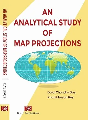
An Analytical Study of Map Projections
Dulal Ch. Das, Dr. Phanibhusan Roy
Paperback
• 338 Pages
• inr 450.00
• English
• 9788197289705
No ratings yet
| Publisher | Bharti Publications |
|---|---|
| Brand/Group | Bharti Publications |
| ISBN13 | 9788197289705 |
| ASIN/SKU | 8197289700 |
| Book Format | Paperback |
| Language | English |
| Pages | 338 |
| List Price | inr 450.00 |
| Dimensions | 15.6 x 2.25 x 23.75 |
| Weight | 450 |
| Book Code | BD00069406 |
Discover An Analytical Study of Map Projections by Dulal Ch. Das. This book is published by Bharti Publications in Paperback format, ISBN 9788197289705, ASIN 8197289700, under Uncategorized, Atlases and Maps, World.
Book Description
AN ANALYTICAL STUDY OF MAP PROJECTIONS
➤ This book is written exclusively on Map Projection, probably the first time in India by any Indian authors.
➤ A systematic as well as logical approach is reflected in this book.
➤There is a fine blending of mathematics with the core content of map projection.
➤ This book is unique as all related aspects of projection i.e. Application of spherical trigonometry, Distance and Azimuth, Variation of scales, UTM Coordinate System, Meridional parts, Direct projections etc are well treated.
➤ This book is written exclusively on Map Projection, probably the first time in India by any Indian authors.
➤ A systematic as well as logical approach is reflected in this book.
➤There is a fine blending of mathematics with the core content of map projection.
➤ This book is unique as all related aspects of projection i.e. Application of spherical trigonometry, Distance and Azimuth, Variation of scales, UTM Coordinate System, Meridional parts, Direct projections etc are well treated.
Author Biography
D.C. Das. M.A., Associate Prof(retd), having immense teaching experiences in undergraduate level for not less than 35 years and sometimes in post- graduate level as an invitee since joining the West Bengal Education Services (WBES), is a very popular teacher in Geography in general and Cartography in particular. He published several textbooks from time to time in accordance with the syllabus of West Bengal Madhyamik Board and H.S. Council for the last 20 years.
Dr. P. Roy, M.A, Ph.D, C.S.M.A (ISI), specialized in cartography at both UG and PG levels. He underwent training in Statistical Methods and Application from ISI, Kolkata. Dr. Roy served Presidency College immediately after post- graduation. Later he joined the Dept of Geography, the University of Burdwan and finally joined the University of Calcutta where he popularly taught Cartography as the main topic of his interest. He completed a project "An Educational Atlas of West Bengal" financed by the UGC.
Dr. P. Roy, M.A, Ph.D, C.S.M.A (ISI), specialized in cartography at both UG and PG levels. He underwent training in Statistical Methods and Application from ISI, Kolkata. Dr. Roy served Presidency College immediately after post- graduation. Later he joined the Dept of Geography, the University of Burdwan and finally joined the University of Calcutta where he popularly taught Cartography as the main topic of his interest. He completed a project "An Educational Atlas of West Bengal" financed by the UGC.
Editorial Reviews
Editorial Reviews will be added soon…
Book Summary
AN ANALYTICAL STUDY OF MAP PROJECTIONS
An Analytical Study of Map Projections is a comprehensive and scholarly work dedicated to the science, mathematics, and practical applications of map projections. As one of the pioneering books on this specialized subject authored by Indian scholars, it fills a significant gap in geographical literature by presenting an in-depth and systematic study of map projections in a manner that is both academically rigorous and accessible to students, researchers, and professionals. The book has been carefully designed to serve as a complete reference for understanding the theoretical foundations, mathematical principles, and practical applications of projecting the curved surface of the Earth onto a flat map.
The book begins by introducing the concept of map projections and explaining why they are indispensable in geography, cartography, surveying, navigation, remote sensing, and Geographic Information Systems (GIS). Since the Earth is approximately spherical while maps are two-dimensional representations, the process of transforming the Earth's surface inevitably introduces distortions in shape, area, distance, or direction. The authors explain these challenges with clarity and demonstrate how different projections are developed to minimise specific types of distortion depending on their intended purpose.
One of the distinguishing features of the book is its logical and systematic organisation. Beginning with the fundamental concepts of the Earth's shape, coordinate systems, and geometric principles, the text gradually advances towards more complex mathematical formulations and projection techniques. Every chapter is structured to build upon previously discussed concepts, allowing readers to develop a strong conceptual foundation before exploring advanced topics. This progressive approach makes the book equally valuable for undergraduate students, postgraduate scholars, competitive examination aspirants, and professionals working in geographical sciences.
A unique strength of the book lies in its successful integration of mathematics with the core concepts of map projections. Unlike many conventional texts that either oversimplify mathematical principles or present them in an overly technical manner, this book achieves an ideal balance between theoretical explanations and mathematical analysis. The authors systematically explain the mathematical derivations involved in constructing various map projections while ensuring that readers understand the practical significance of each formula. This integration enables learners to appreciate not only how projections are developed but also why different mathematical approaches are employed under varying geographical conditions.
The book provides detailed coverage of spherical trigonometry, which forms the mathematical backbone of map projection studies. Fundamental concepts, formulae, and applications of spherical triangles are thoroughly explained with suitable illustrations and worked examples. Readers gain a clear understanding of how spherical trigonometry is used in determining positions, calculating distances, and solving navigational problems on the Earth's surface.
Another important aspect comprehensively addressed in the book is the measurement of distance and azimuth. The authors explain various methods for calculating the shortest distance between two locations on the Earth's surface and discuss the significance of azimuth in navigation, surveying, aviation, and military mapping. The mathematical treatment is accompanied by practical examples that help readers understand real-world applications of these concepts.
The variation of scales, a critical issue in map projections, receives detailed attention throughout the text. Since no projection can preserve all geographical properties simultaneously, the book carefully analyses how scale changes across different projections and how these variations influence map interpretation. Readers are introduced to methods of calculating scale factors, understanding distortion patterns, and selecting suitable projections for specific mapping objectives.
Recognising the importance of modern mapping technologies, the book also presents an extensive discussion on the Universal Transverse Mercator (UTM) Coordinate System. The principles underlying the UTM system, zone divisions, coordinate calculations, and practical applications in surveying, GPS, remote sensing, and GIS are explained in a clear and systematic manner. This section bridges classical cartographic theory with contemporary geospatial practices, making the book highly relevant in the era of digital mapping.
The treatment of meridional parts and direct projections further distinguishes this work from conventional textbooks. The authors carefully explain the derivation, computation, and application of meridional parts in constructing conformal projections, while direct projection methods are presented with detailed mathematical procedures and practical examples. These discussions provide readers with a deeper understanding of projection construction techniques that are often overlooked in standard geographical texts.
Throughout the book, numerous diagrams, mathematical illustrations, tables, and solved numerical problems are included to enhance comprehension. These visual aids simplify complex concepts and enable readers to develop analytical skills necessary for solving projection-related problems. The inclusion of step-by-step calculations makes the book particularly useful for classroom instruction, self-study, and examination preparation.
The language of the book is precise, academic, and reader-friendly, ensuring that even mathematically intensive topics remain approachable. Complex theories are explained in a logical sequence with appropriate examples, making the subject less intimidating for students while maintaining the scholarly depth expected by researchers and professionals. Each chapter reinforces conceptual understanding through carefully selected examples that connect theoretical knowledge with practical cartographic applications.
Beyond its academic value, the book serves as a practical guide for professionals engaged in surveying, urban planning, environmental management, disaster management, defence mapping, transportation planning, and geospatial analysis. The principles discussed are directly applicable to modern GIS software, satellite mapping, digital cartography, and spatial data analysis, thereby enhancing the practical utility of the text.
In essence, *An Analytical Study of Map Projections* is a unique and authoritative contribution to the field of geography and cartography. By combining mathematical precision with conceptual clarity, the book provides a comprehensive understanding of projection theory and practice. Its systematic presentation, analytical approach, extensive coverage of advanced topics, and practical orientation make it an indispensable resource for students, educators, researchers, cartographers, surveyors, and GIS professionals. The work stands as a valuable reference that successfully bridges classical geographical knowledge with the demands of contemporary spatial science and modern geospatial technologies.
An Analytical Study of Map Projections is a comprehensive and scholarly work dedicated to the science, mathematics, and practical applications of map projections. As one of the pioneering books on this specialized subject authored by Indian scholars, it fills a significant gap in geographical literature by presenting an in-depth and systematic study of map projections in a manner that is both academically rigorous and accessible to students, researchers, and professionals. The book has been carefully designed to serve as a complete reference for understanding the theoretical foundations, mathematical principles, and practical applications of projecting the curved surface of the Earth onto a flat map.
The book begins by introducing the concept of map projections and explaining why they are indispensable in geography, cartography, surveying, navigation, remote sensing, and Geographic Information Systems (GIS). Since the Earth is approximately spherical while maps are two-dimensional representations, the process of transforming the Earth's surface inevitably introduces distortions in shape, area, distance, or direction. The authors explain these challenges with clarity and demonstrate how different projections are developed to minimise specific types of distortion depending on their intended purpose.
One of the distinguishing features of the book is its logical and systematic organisation. Beginning with the fundamental concepts of the Earth's shape, coordinate systems, and geometric principles, the text gradually advances towards more complex mathematical formulations and projection techniques. Every chapter is structured to build upon previously discussed concepts, allowing readers to develop a strong conceptual foundation before exploring advanced topics. This progressive approach makes the book equally valuable for undergraduate students, postgraduate scholars, competitive examination aspirants, and professionals working in geographical sciences.
A unique strength of the book lies in its successful integration of mathematics with the core concepts of map projections. Unlike many conventional texts that either oversimplify mathematical principles or present them in an overly technical manner, this book achieves an ideal balance between theoretical explanations and mathematical analysis. The authors systematically explain the mathematical derivations involved in constructing various map projections while ensuring that readers understand the practical significance of each formula. This integration enables learners to appreciate not only how projections are developed but also why different mathematical approaches are employed under varying geographical conditions.
The book provides detailed coverage of spherical trigonometry, which forms the mathematical backbone of map projection studies. Fundamental concepts, formulae, and applications of spherical triangles are thoroughly explained with suitable illustrations and worked examples. Readers gain a clear understanding of how spherical trigonometry is used in determining positions, calculating distances, and solving navigational problems on the Earth's surface.
Another important aspect comprehensively addressed in the book is the measurement of distance and azimuth. The authors explain various methods for calculating the shortest distance between two locations on the Earth's surface and discuss the significance of azimuth in navigation, surveying, aviation, and military mapping. The mathematical treatment is accompanied by practical examples that help readers understand real-world applications of these concepts.
The variation of scales, a critical issue in map projections, receives detailed attention throughout the text. Since no projection can preserve all geographical properties simultaneously, the book carefully analyses how scale changes across different projections and how these variations influence map interpretation. Readers are introduced to methods of calculating scale factors, understanding distortion patterns, and selecting suitable projections for specific mapping objectives.
Recognising the importance of modern mapping technologies, the book also presents an extensive discussion on the Universal Transverse Mercator (UTM) Coordinate System. The principles underlying the UTM system, zone divisions, coordinate calculations, and practical applications in surveying, GPS, remote sensing, and GIS are explained in a clear and systematic manner. This section bridges classical cartographic theory with contemporary geospatial practices, making the book highly relevant in the era of digital mapping.
The treatment of meridional parts and direct projections further distinguishes this work from conventional textbooks. The authors carefully explain the derivation, computation, and application of meridional parts in constructing conformal projections, while direct projection methods are presented with detailed mathematical procedures and practical examples. These discussions provide readers with a deeper understanding of projection construction techniques that are often overlooked in standard geographical texts.
Throughout the book, numerous diagrams, mathematical illustrations, tables, and solved numerical problems are included to enhance comprehension. These visual aids simplify complex concepts and enable readers to develop analytical skills necessary for solving projection-related problems. The inclusion of step-by-step calculations makes the book particularly useful for classroom instruction, self-study, and examination preparation.
The language of the book is precise, academic, and reader-friendly, ensuring that even mathematically intensive topics remain approachable. Complex theories are explained in a logical sequence with appropriate examples, making the subject less intimidating for students while maintaining the scholarly depth expected by researchers and professionals. Each chapter reinforces conceptual understanding through carefully selected examples that connect theoretical knowledge with practical cartographic applications.
Beyond its academic value, the book serves as a practical guide for professionals engaged in surveying, urban planning, environmental management, disaster management, defence mapping, transportation planning, and geospatial analysis. The principles discussed are directly applicable to modern GIS software, satellite mapping, digital cartography, and spatial data analysis, thereby enhancing the practical utility of the text.
In essence, *An Analytical Study of Map Projections* is a unique and authoritative contribution to the field of geography and cartography. By combining mathematical precision with conceptual clarity, the book provides a comprehensive understanding of projection theory and practice. Its systematic presentation, analytical approach, extensive coverage of advanced topics, and practical orientation make it an indispensable resource for students, educators, researchers, cartographers, surveyors, and GIS professionals. The work stands as a valuable reference that successfully bridges classical geographical knowledge with the demands of contemporary spatial science and modern geospatial technologies.
Sample Chapters
Sample Chapters will be added soon…
Build Author or Publisher Website in Minutes
- Design a stunning professional website in minutes to showcase your portfolio, new releases, series, and bestselling titles.
- Use world-class cataloging software to create the metadata of your books. You will forget managing your metadata in excel.
- Share your large cover image and real-time metadata in with the publishing industry.
- Promote your books seamlessly across the Booksdata.org ecosystem and connect directly with a highly engaged reading community.